Gather Information
The first part of developing a management plan for BMAD is to collect as much information as possible about your management area, including all sites where there is or could be BMAD, mapping vegetation types, dense (lantana of other) areas, existing BMAD damage and bell miner activity.
1. Define your project area
Your BMAD project area can be any area, so long as it clearly defined. For the best results, its should cover the whole area of bell miner activity, including any vulnerable forest areas in the vicinity. Ideally, this is at a sub-catchment scale, but property boundaries and roads can also be used to define the project area. Working with neighbours with similar habitat of BMAD issues will improve your chances of success.
Begin with a rapid assessment of bell miner activity and BMAD affected forest in the general area, sketch a map of these locations. Consider areas that are potential bell miner habitat.
This will inform the location of your work area. Draw the boundary of the management area on a map. You can print maps from various sources on line such as Google maps, Google Earth and Six Maps, however, the best idea is to buy a 1:25000 Topo Map from you nearest newsagent or camping store. It will provide you with a lot of useful information such as water ways, roads and contour lines. Laminate it and use whiteboard markers to develop your map. Use permanent markers when you are confident you map is complete.


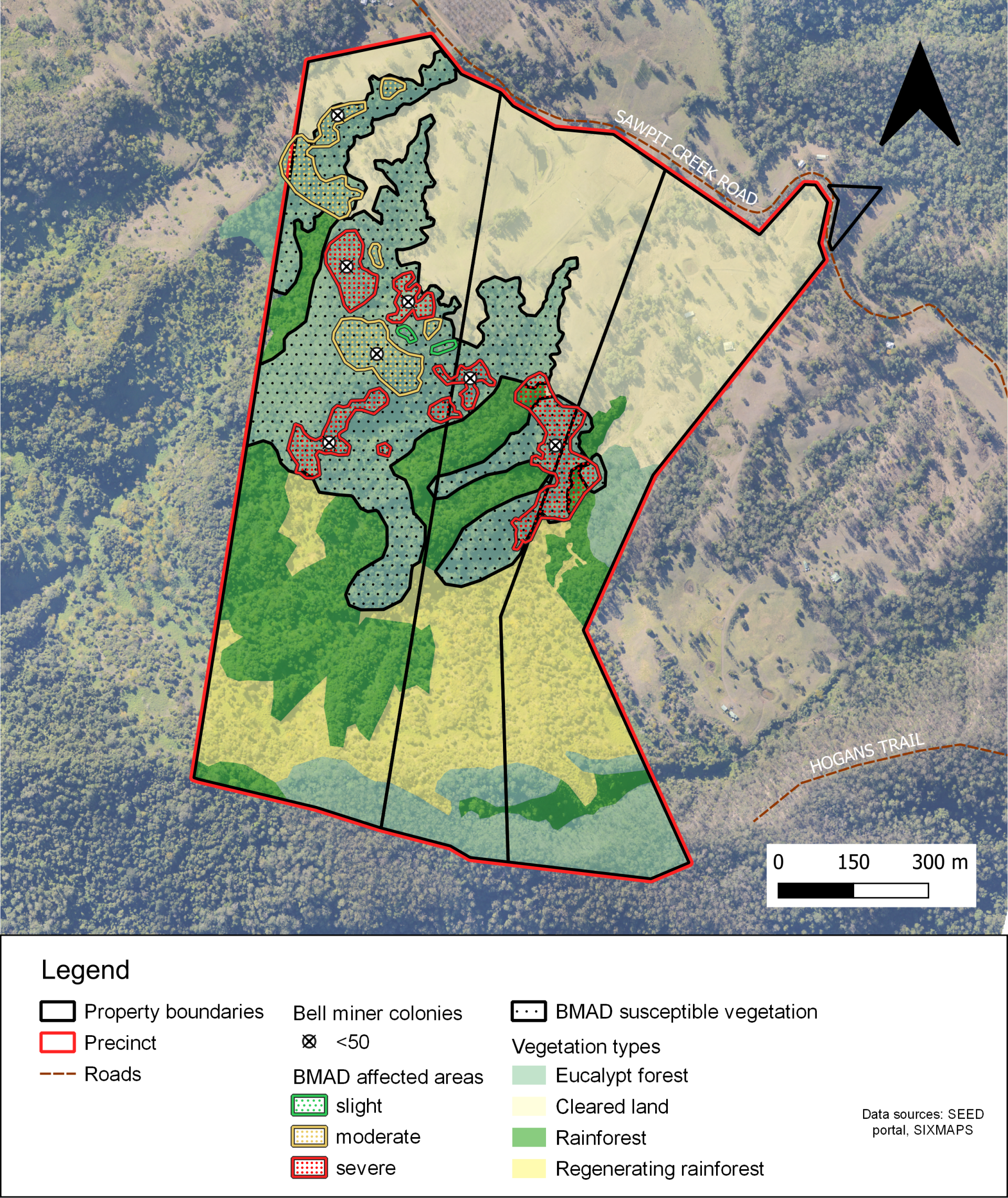
2. Map your vegetation
Map the broad vegetation types in the area. This can be as simple as identifying cleared, non-forest, eucalypt and non-eucalypt forest types. If you can, go a step further and identify dry and wet forest types. Draw polygons (shapes) around the boundaries of the vegetation types. Depending on where you live you can find useful vegetation mapping resources on your local government website. The phone App Trees Near Me also provides detailed vegetation information for you current location which can be a useful guide.
3. Map mid-storey density
Map areas with an unnaturally dense mid-storey layer. This is generally vegetation between 2 and 6m in height that is difficult to walk through and is found in areas of forest with higher light levels under a disturbed canopy layer above. On the north coast of NSW this will usually be lantana thickets but can also be native vines or other vegetation types. Use a different set of colours if you want to mark out very dense from less dense areas. Current aerial imagery as found on Google earth can be useful in working out the perimetre of these areas with lantana showing as bright light green.

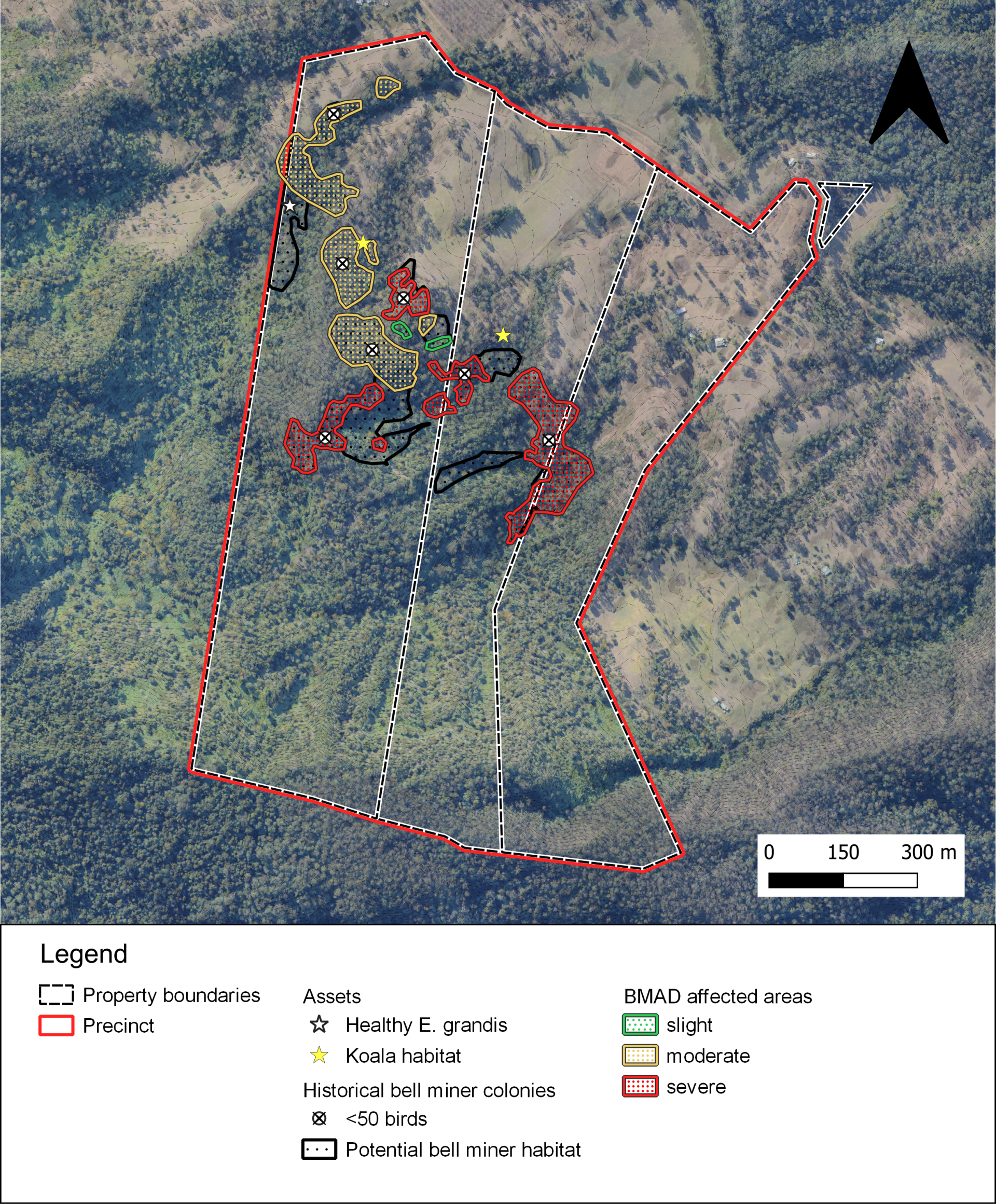
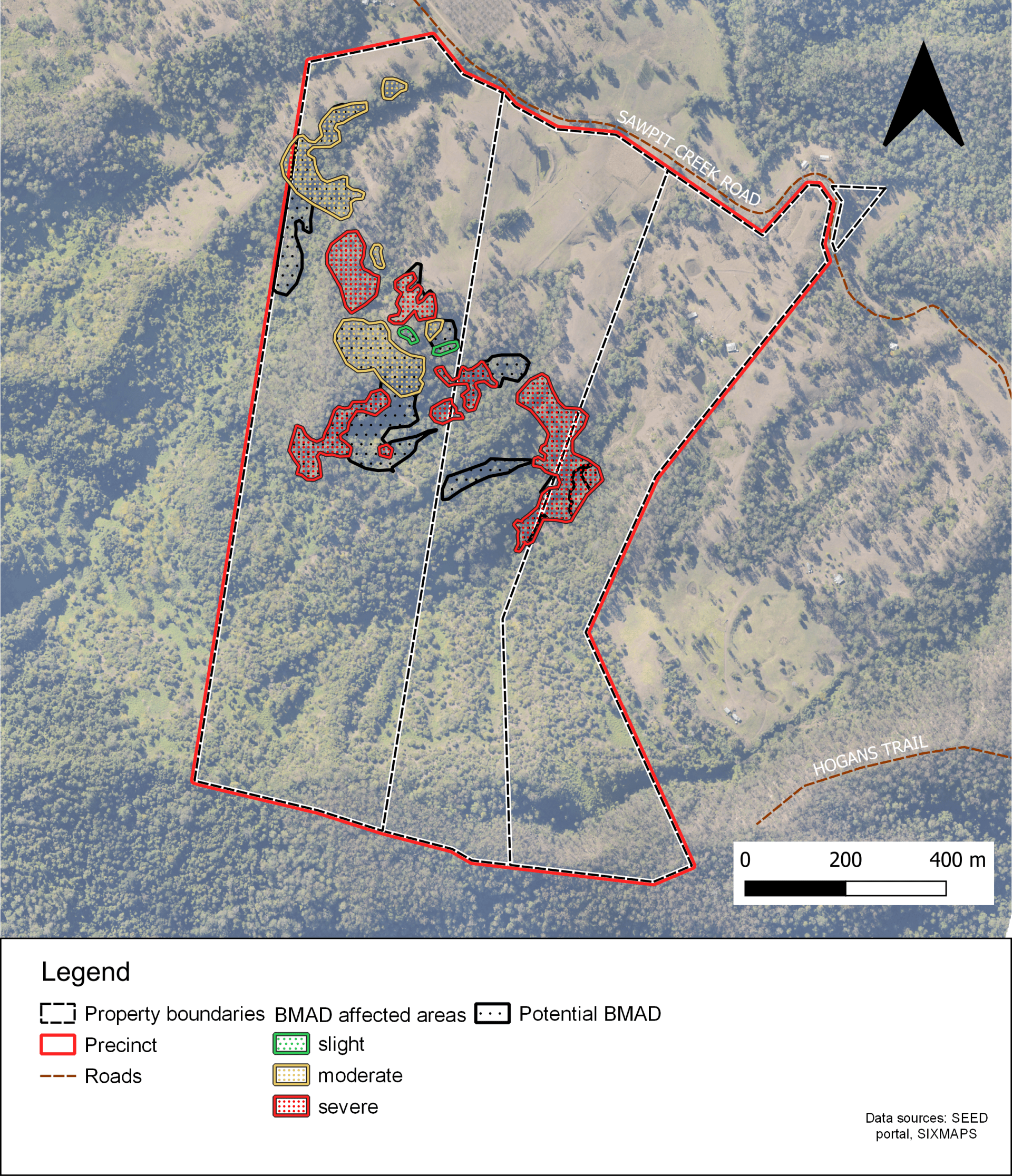
4. Locate existing damage and bell miner colonies
Add areas of existing BMAD damage to you map, drawing around each affected area. Note the severity of BMAD damage. Mark out the locations of current and historic bell miner colonies if possible. Include all bell miner colonies in the project area and nearby, including areas that are inaccessible.
5. BMAD-susceptible areas
If you are able, you can add a layer defining the areas of forest which contain BMAD susceptible eucalypt species, see our page on tree types. If these areas overlap with other BMAD factors they may need management. If not, then maintaining them in good condition is the objective.
6. Locate assets and areas of interest
As an option, you can add any other assets or areas of interest that may affect how you prioritise the areas to be treated. This could include threatened species, areas that are easy or difficult to access or economic assets (e.g. vulnerable eucalypt plantations).
7. Define your management zones
By now your map is getting very busy. Looking at your map, see where the steps overlap. Areas intersected by Step 3 and 4, are ground-zero. This is where BMAD is active and is you primary focus. Areas where step 1 and 5 overlay and are adjacent to these areas show you the areas at risk of BMAD. You can refine and prioritise work in these areas by overlaying information from Step 6.
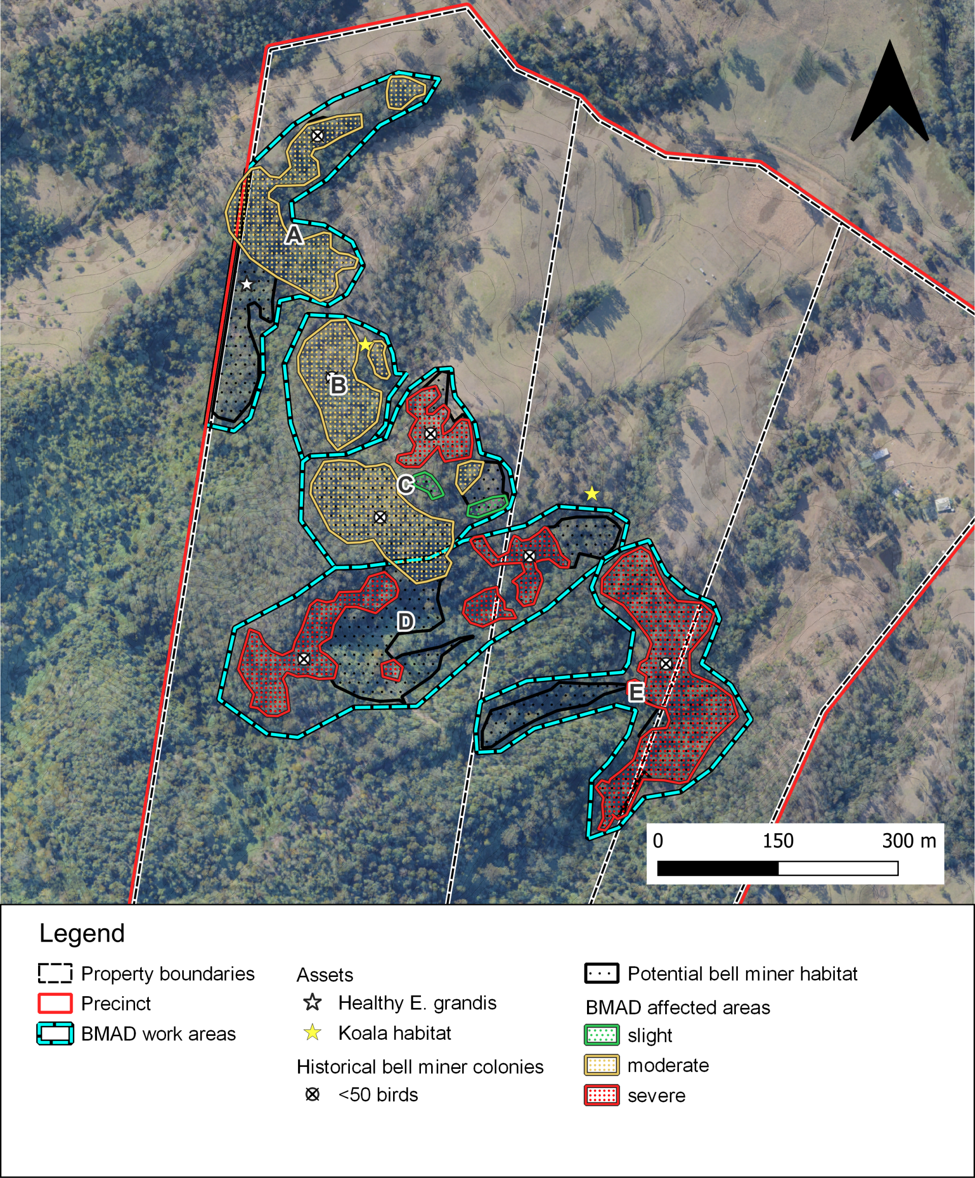
Now that you know where your BMAD threats lie, you can assess the situation at hand and set informed priorities.